 Geocatalogue of the Royal Museum for Central Africa
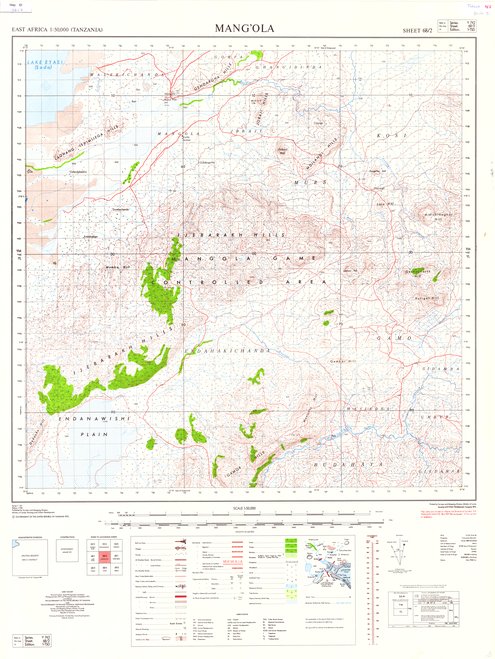
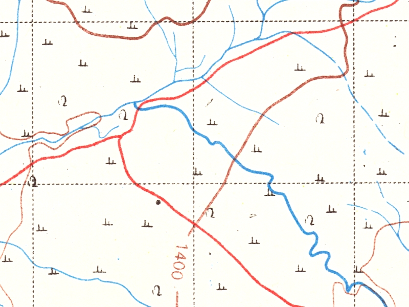
Mang'Ola - Topographical map series : 1/50.000 East Africa (Tanzania) Serie : Y742
Title: Mang'Ola, Topographical map series : 1/50.000
East Africa (Tanzania)
Serie : Y742 - Scale: 50000 - Sheet number/Numéro de feuille/Bladnummer: 68/2
Simple
- Date (Creation)
- Date (creationEndDate)
- Date (creationEndDate)
- Citation identifier
- 001627
- Keywords
-
-
Mang'Ola
-
- Keywords
-
-
Tanzania
-
- Keywords
-
- Keywords
-
-
dénominations géographiques
-
- Keywords
-
-
miscellaneous
-
- Keywords
-
-
topographic map
-
- Use limitation
-
© Royal Museum for Central Africa
- Access constraints
- Other restrictions
- Other constraints
-
© Royal Museum for Central Africa
- Denominator
- 50000
- crt:MD_ScaleRemark
-
échelle calculée
- Language
- eng_us
- Topic category
-
- Geoscientific information
- Environment
N
S
E
W
))
- crt:originType
-
Auteur
- crt:originType
-
Éditeur
- crt:originName
-
Surveys and Mapping Division, Ministry of Lands, Housing and Urban Development, Tanzania
- crt:originType
-
Éditeur
- crt:originName
-
Royal Museum for Central Africa
- crt:originType
-
Responsable éditorial
- Reference system identifier
- RMCA:custom / Transverse Mercator / 0.9
- Distribution format
-
-
hardcopy
(
)
-
hardcopy
(
)
- Hierarchy level
- Dataset
Conformance result
- Date (Publication)
- 2014-03-04
- Explanation
-
inapplicable
- Statement
-
Date verification: 2016-05-12 00:00:00, Name verification: EG
- File identifier
- BE-RMCA-EARTHS-001627 XML
- Metadata language
- fre_be
- Hierarchy level
- Dataset
- Date stamp
- 2023-09-06
Point of contact
Royal Museum for Central Africa
-
maps@africamuseum.be
(
Unité Cartographie (Dept. Sciences de la Terre)
)
Royal Museum for Central Africa, Leuvensesteenweg, 13, 3080 Tervuren
,
Tervuren
,
3080
,
Belgium
Overviews
Spatial extent
N
S
E
W
Provided by

Associated resources
Not available