 Geocatalogue of the Royal Museum for Central Africa
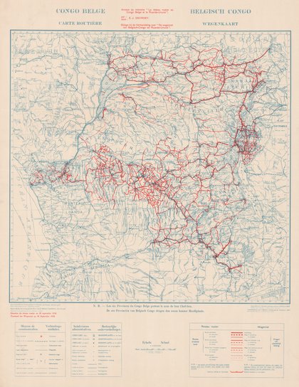
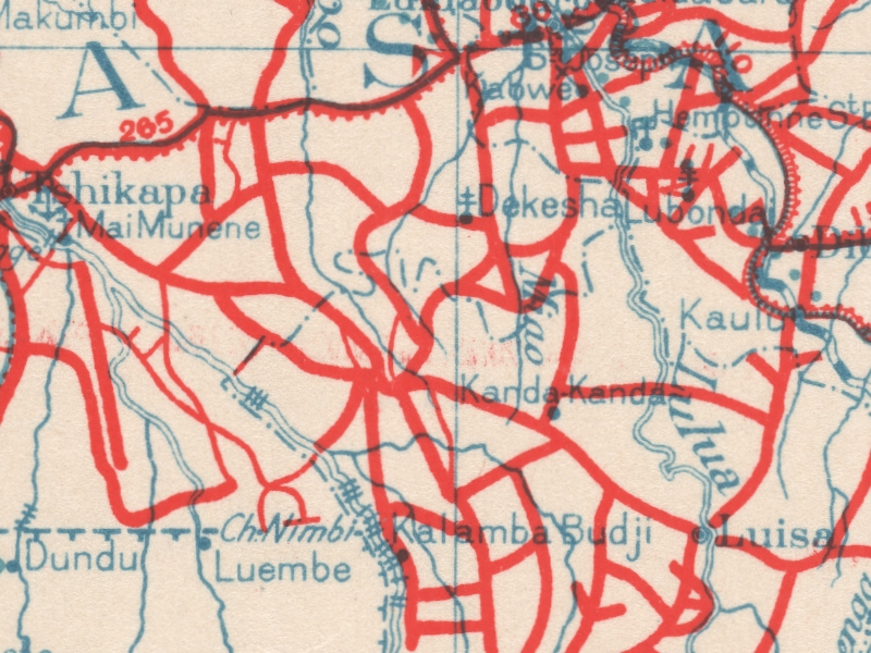
Carte routière du Congo Belge - Wegenkaart van Belgisch Congo
Title: Carte routière du Congo Belge, Wegenkaart van Belgisch Congo - Scale: 5000000 - annexe au mémoire "Le réseau routier au Congo Belge et le Ruanda-Urundi"
Bijlage bij de Verhandeling over "De wegennet van Belgisch-Congo en Ruanda-Urundi"
Simple
- Date (Creation)
- 1938-01-01
- Date (creationEndDate)
- 1938-12-31
- Date (creationEndDate)
- 1938-01-01
- Citation identifier
- 019451
- Keywords
-
-
Congo R.D.
-
- Keywords
-
- Keywords
-
-
dénominations géographiques
-
- Keywords
-
-
réseaux de transport
-
- Keywords
-
-
unités administratives
-
- Keywords
-
-
hydrologic map
-
- Keywords
-
-
hydrology
-
- Keywords
-
-
miscellaneous
-
- Keywords
-
-
topographic map
-
- Use limitation
-
© Royal Museum for Central Africa
- Access constraints
- Other restrictions
- Other constraints
-
© Royal Museum for Central Africa
- Denominator
- 5000000
- crt:MD_ScaleRemark
-
échelle calculée
- Language
- eng_us
- Topic category
-
- Geoscientific information
- Environment
))
- Begin date
- 1938-01-01
- End date
- 1938-12-31
- crt:originType
-
Auteur
- crt:originName
-
Devroey, E.J.
- crt:originType
-
Éditeur
- crt:originName
-
Service Cartographique, Ministère des Colonies
- crt:originType
-
Éditeur
- crt:originName
-
Royal Museum for Central Africa
- crt:originType
-
Responsable éditorial
- Codespace
-
RMCA:custom
- Version
-
0.9
- Distribution format
-
-
hardcopy
(
)
-
hardcopy
(
)
- Hierarchy level
- Dataset
Conformance result
- Date (Publication)
- 2014-03-04
- Explanation
-
inapplicable
- Statement
-
Date verification: 2019-07-02 00:00:00, Name verification: EG
- File identifier
- BE-RMCA-EARTHS-019451 XML
- Metadata language
- fre_be
- Hierarchy level
- Dataset
- Date stamp
- 2023-09-06
Overviews
Spatial extent
Provided by
