 Geocatalogue of the Royal Museum for Central Africa
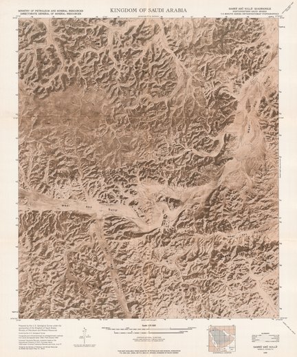
7.5-Minute Series Orthophotomap (Topographic) - Kingdom of Saudi Arabia Samra' Abu Sulla' quadrangle (Northwestern Saudi Arabia)
Title: 7.5-Minute Series Orthophotomap (Topographic), Kingdom of Saudi Arabia
Samra' Abu Sulla' quadrangle (Northwestern Saudi Arabia) - Scale: 25000 - Prepared by the U.S. Geological Survey under the sponsorship of the Kingdom of Saudi Arabia, Ministry of Petroleum and Mineral Resources - Sheet number/Numéro de feuille/Bladnummer: N2952.5-E3745/7.5
Simple
- Date (Creation)
- 1969-01-01
- Date (creationEndDate)
- 1969-12-31
- Date (creationEndDate)
- 1969-01-01
- Citation identifier
- 031530
- Keywords
-
-
Samra' Abu Sulla'
-
- Keywords
-
-
Saudi Arabia
-
- Keywords
-
- Keywords
-
-
dénominations géographiques
-
- Keywords
-
-
miscellaneous
-
- Keywords
-
-
topographic map
-
- Use limitation
-
© Royal Museum for Central Africa
- Access constraints
- Other restrictions
- Other constraints
-
© Royal Museum for Central Africa
- Denominator
- 25000
- crt:MD_ScaleRemark
-
échelle calculée
- Language
- eng_us
- Topic category
-
- Geoscientific information
- Environment
))
- Begin date
- 1969-01-01
- End date
- 1969-12-31
- crt:originType
-
Auteur
- crt:originName
-
Anonymous
- crt:originType
-
Éditeur
- crt:originName
-
United States Geological Survey
- crt:originType
-
Éditeur
- crt:originName
-
Royal Museum for Central Africa
- crt:originType
-
Responsable éditorial
- crt:originName
-
Ministry of Petroleum and Mineral Resources, Riyadh
- Reference system identifier
- RMCA:custom / Transverse Mercator / 0.9
- Distribution format
-
-
hardcopy
(
)
-
hardcopy
(
)
- Hierarchy level
- Dataset
Conformance result
- Date (Publication)
- 2014-03-04
- Explanation
-
inapplicable
- Statement
-
Date verification: 2023-08-01 00:00:00, Name verification: EG
- File identifier
- BE-RMCA-EARTHS-031530 XML
- Metadata language
- Français
- Hierarchy level
- Dataset
- Date stamp
- 2025-11-07
Overviews
Spatial extent
Provided by
