 Geocatalogue of the Royal Museum for Central Africa
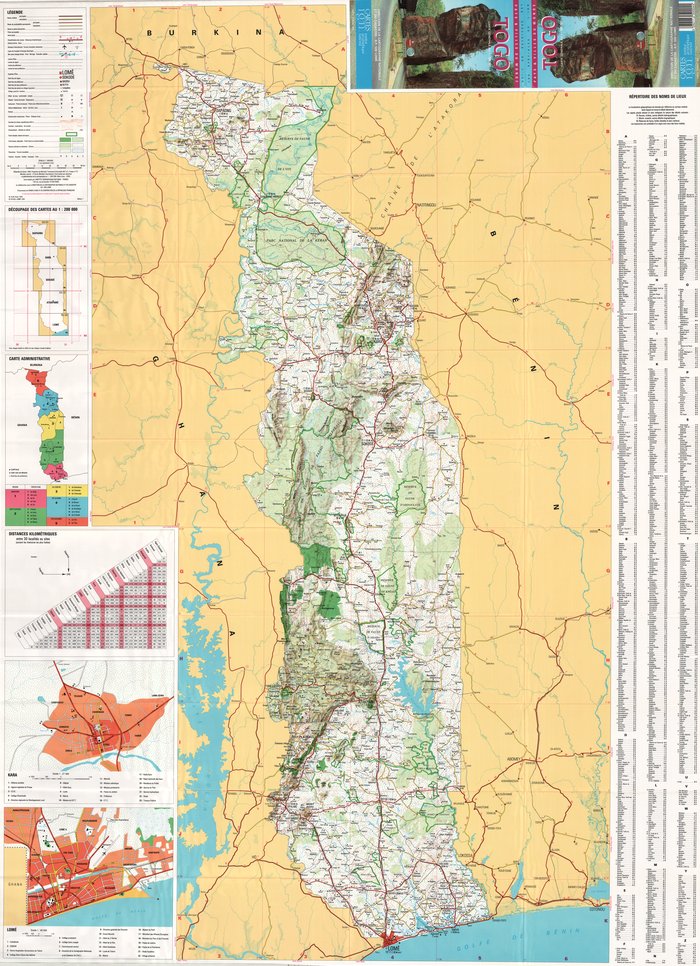
Les spéciales de l'IGN : Pays et villes du monde - Togo Carte générale au 1 : 500.000
Title: Les spéciales de l'IGN : Pays et villes du monde, Togo
Carte générale au 1 : 500.000 - Scale: 500000 - Sheet number/Numéro de feuille/Bladnummer: 1
Simple
- Date (Creation)
- 1991-01-01
- Date (creationEndDate)
- 1991-12-31
- Date (creationEndDate)
- 1991-01-01
- Citation identifier
- 040136
- Keywords
-
-
Togo
-
- Keywords
-
- Keywords
-
-
dénominations géographiques
-
- Keywords
-
-
réseaux de transport
-
- Keywords
-
-
miscellaneous
-
- Keywords
-
-
topographic map
-
- Use limitation
-
© Royal Museum for Central Africa
- Access constraints
- Other restrictions
- Other constraints
-
© Royal Museum for Central Africa
- Denominator
- 500000
- crt:MD_ScaleRemark
-
échelle calculée
- Language
- eng_us
- Topic category
-
- Geoscientific information
- Environment
))
- Begin date
- 1991-01-01
- End date
- 1991-12-31
- crt:originType
-
Auteur
- crt:originType
-
Éditeur
- crt:originName
-
Direction de la Cartographie Nationale et du Cadastre, Lomé
- crt:originType
-
Éditeur
- crt:originName
-
Institut Géographique National, France
- crt:originType
-
Éditeur
- crt:originName
-
Royal Museum for Central Africa
- crt:originType
-
Responsable éditorial
- crt:originName
-
Direction de la Cartographie Nationale et du Cadastre, Lomé
- crt:originType
-
Responsable éditorial
- crt:originName
-
Institut Géographique National, France
- Reference system identifier
- RMCA:custom / UTM / 0.9
- Distribution format
-
-
hardcopy
(
)
-
hardcopy
(
)
- Hierarchy level
- Dataset
Conformance result
- Date (Publication)
- 2014-03-04
- Explanation
-
inapplicable
- Statement
-
Date verification: 2024-07-31 10:09:23, Name verification: EG
- File identifier
- BE-RMCA-EARTHS-040136 XML
- Metadata language
- Français
- Hierarchy level
- Dataset
- Date stamp
- 2025-11-07
Overviews
Spatial extent
Provided by
