 Geocatalogue of the Royal Museum for Central Africa
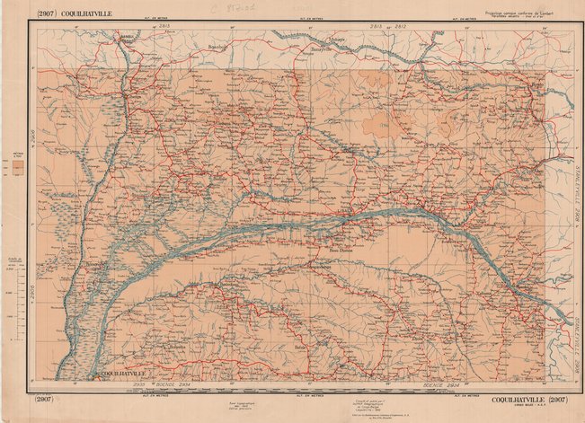
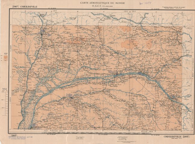
Carte de Coquilhatville en République Démocratique du Congo (1950)
Cette carte renseigne sur les aspects topographique de Coquilhatville (Mbandaka) en république démocratique du Congo vers les années 1950.
Simple
- Date (Publication)
- 1950-01-01
- Date (Creation)
- 1950-01-01
- Date (Revision)
- 1950-01-01
- Citation identifier
- CD-CRSN-DOC1624
-
-
rdc
-
-
-
coquilhatville
-
-
-
topographique
-
-
GEMET - INSPIRE Themes
-
-
Dénominations géographiques
-
-
GEMET - INSPIRE Themes
-
-
Adresses
-
-
GEMET - INSPIRE Themes
-
-
Geographical names
-
- Access constraints
- Other restrictions
- Other constraints
-
No restriction for public access with INSPIRE
- Denominator
- 0
- Language
- Français
- Topic category
-
- Location
- Description
-
Liste des emprises
N
S
E
W
))
- Reference system identifier
- urn:ogc:def:crs:EPSG:6.11 / 4258 / 6.11
- Distribution format
-
-
GeoTIFF
(
)
-
GeoTIFF
(
)
- Name of the resource
-
Centre de Recherches en Sciences Naturelles (CRSN) Lwiro
- Hierarchy level
- Dataset
Conformance result
- Date (Creation)
- 2010-11-23
- Explanation
-
See the referenced specification
- Pass
- Yes
- Statement
-
Compilation et publication par l'Institut Géographique du Congo Belge à Léopoldville en 1950.
- File identifier
- CD-CRSN-DOC1624 XML
- Metadata language
- Français
- Character set
- MD_CharacterSetCode_utf8
- Hierarchy level
- Dataset
- Date stamp
- 2018-04-19
- Metadata standard name
-
ISO19115
- Metadata standard version
-
2003/Cor.1:2006
Point of contact
Centre de Recherche en Sciences Naturelles (CRSN) Lwiro
Lwiro
,
Bukavu
,
00000
,
Belgium
None
Overviews
Spatial extent
N
S
E
W
Provided by

Associated resources
Not available