 Geocatalogue of the Royal Museum for Central Africa
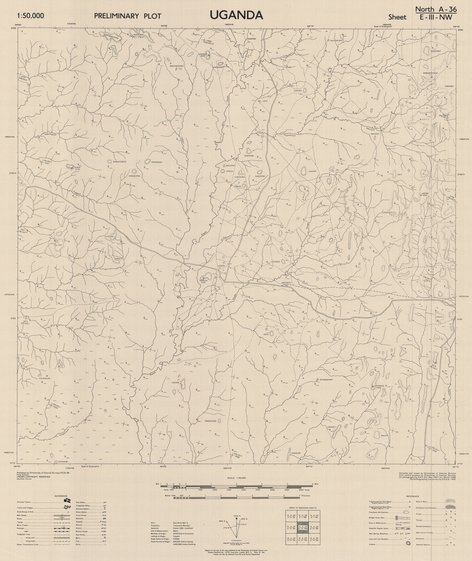
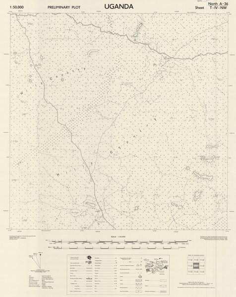
Map of Uganda Sheet North A 36 T-IV-NW
Cette carte informe sur les aspects topographiques et routiers concernant une partie de l'Uganda, vers les années 1953.
Simple
- Date (Publication)
- 1953-01-01
- Date (Creation)
- 1950-01-01
- Date (Revision)
- 1953-01-01
- Citation identifier
- CD-CRSN-DOC1691
-
-
uganda
-
-
-
route
-
-
-
agglomération
-
-
-
localisation
-
-
GEMET - INSPIRE Themes
-
-
Adresses
-
-
GEMET - INSPIRE Themes
-
-
Occupation des terres
-
-
GEMET - INSPIRE Themes
-
-
Geographical names
-
-
GEMET - INSPIRE Themes
-
-
Land cover
-
- Use limitation
-
None
- Access constraints
- Other restrictions
- Other constraints
-
No restriction for public access with INSPIRE
- Denominator
- 50000
- Language
- English
- Topic category
-
- Location
- Imagery base maps earth cover
- Description
-
Liste des emprises
))
- Reference system identifier
- urn:ogc:def:crs:EPSG:6.11 / 4258 / 6.11
- Distribution format
-
-
GeoTIFF
(
None
)
-
GeoTIFF
(
None
)
- Name of the resource
-
Centre de Recherches en Sciences Naturelles (CRSN) Lwiro
- Hierarchy level
- Dataset
Conformance result
- Date (Creation)
- 2010-11-23
- Explanation
-
See the referenced specification
- Pass
- Yes
- Statement
-
Compiled and drawn by Directorate of Colonial Surveys. From control supplied by the Admiralty W.A.F.S.C. Survey Dept of Gambia and Radar Fixes. Supplied by Nº6 R.A.S.L.S.
Air photography by R.A.F. January and February 1950.
Photolithographed and printed by G.S.G.S. 1953.
- File identifier
- CD-CRSN-DOC1691 XML
- Metadata language
- Français
- Character set
- MD_CharacterSetCode_utf8
- Hierarchy level
- Dataset
- Date stamp
- 2018-05-08
- Metadata standard name
-
ISO19115
- Metadata standard version
-
2003/Cor.1:2006
Overviews
Spatial extent
Provided by
