 Geocatalogue of the Royal Museum for Central Africa
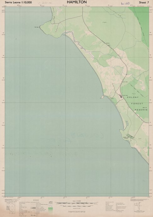
Map of Sierra Leone (Hamilton), 1948
Cette carte topographique livre divers renseignements concernant Hamilton une entité de Sierre Leone vers les années 1948.
Simple
- Date (Publication)
- 1948-01-01
- Date (Creation)
- 1948-01-01
- Date (Revision)
- 1948-01-01
- Citation identifier
- CD-CRSN-DOC1753
Owner
Centre de Recherche en Sciences Naturelles (CRSN) Lwiro
Lwiro
,
Bukavu
,
00000
,
République Démocratique du Congo
None
-
-
sierre leone
-
-
-
hamilton
-
-
-
route
-
-
-
infrastructure
-
-
-
localisation
-
-
GEMET - INSPIRE Themes
-
-
Réseaux de transport
-
-
GEMET - INSPIRE Themes
-
-
Occupation des terres
-
- Use limitation
-
None
- Access constraints
- Other restrictions
- Other constraints
-
Pas de restriction d'accès public selon INSPIRE
- Denominator
- 10000
- Language
- English
- Topic category
-
- Transportation
- Imagery base maps earth cover
- Description
-
Liste des emprises
N
S
E
W
))
- Reference system identifier
- urn:ogc:def:crs:EPSG:6.11 / 4258 / 6.11
- Distribution format
-
-
GeoTIFF
(
None
)
-
GeoTIFF
(
None
)
- Name of the resource
-
Centre de Recherche en Sciences Naturelles (CRSN) Lwiro
- Hierarchy level
- Dataset
Conformance result
- Date (Creation)
- 2010-11-23
- Explanation
-
See the referenced specification
- Pass
- Yes
- Statement
-
Compiled and drawn by Directorate of colonial surveys. Air Force Ground control by Sierra Leone survey departement.
Photolithographed and printed by G.S.G.S. 1948.
- File identifier
- CD-CRSN-DOC1753 XML
- Metadata language
- Français
- Character set
- MD_CharacterSetCode_utf8
- Hierarchy level
- Dataset
- Date stamp
- 2018-06-21
- Metadata standard name
-
ISO19115
- Metadata standard version
-
2003/Cor.1:2006
Point of contact
Centre de Recherche en Sciences Naturelles (CRSN) Lwiro
Lwiro
,
Bukavu
,
00000
,
République Démocratique du Congo
None
Overviews
Spatial extent
N
S
E
W
Provided by

Associated resources
Not available