 Geocatalogue of the Royal Museum for Central Africa
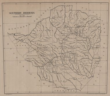
Map of Southern Rhodesia, 1951
Cette carte renseigne sur divers informations relatifs aux aspects topographiques et administratifs d'une entité de la partie sud de Rhodesia vers les années 1951.
Simple
- Date (Publication)
- 1951-01-01
- Date (Creation)
- 1951-01-01
- Date (Revision)
- 1951-01-01
- Citation identifier
- CD-CRSN-DOC1755
Owner
Centre de Recherche en Sciences Naturelles (CRSN) Lwiro
Lwiro
,
Bukavu
,
00000
,
République Démocratique du Congo
None
-
-
rhodesia
-
-
-
sud
-
-
-
localisation
-
-
-
localisation
-
-
GEMET - INSPIRE Themes
-
-
Unités administratives
-
-
GEMET - INSPIRE Themes
-
-
Occupation des terres
-
- Use limitation
-
None
- Access constraints
- Other restrictions
- Other constraints
-
Pas de restriction d'accès public selon INSPIRE
- Denominator
- 0
- Language
- English
- Topic category
-
- Boundaries
- Imagery base maps earth cover
- Description
-
Liste des emprises
N
S
E
W
))
- Reference system identifier
- urn:ogc:def:crs:EPSG:6.11 / 4258 / 6.11
- Distribution format
-
-
GeoTIFF
(
None
)
-
GeoTIFF
(
None
)
- Name of the resource
-
Centre de Recherche en Sciences Naturelles (CRSN) Lwiro
- Hierarchy level
- Dataset
Conformance result
- Date (Creation)
- 2010-11-23
- Explanation
-
See the referenced specification
- Pass
- Yes
- Statement
-
Drawn and printed at the Survayor General's Office Salusbury, Rhodesia 1951.
- File identifier
- CD-CRSN-DOC1755 XML
- Metadata language
- Français
- Character set
- MD_CharacterSetCode_utf8
- Hierarchy level
- Dataset
- Date stamp
- 2018-06-21
- Metadata standard name
-
ISO19115
- Metadata standard version
-
2003/Cor.1:2006
Point of contact
Centre de Recherche en Sciences Naturelles (CRSN) Lwiro
Lwiro
,
Bukavu
,
00000
,
République Démocratique du Congo
None
Overviews
Spatial extent
N
S
E
W
Provided by

Associated resources
Not available