 Geocatalogue of the Royal Museum for Central Africa
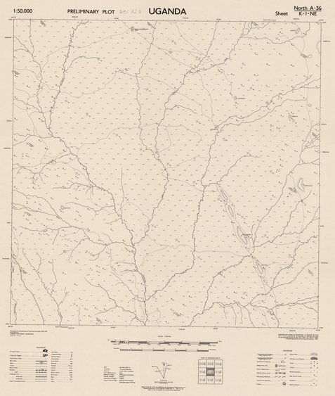
Map of Uganda Sheet North A 36 K-I-NE, 1951
Cette carte informe sur les aspects topographiques et routiers d'une partie de l'Uganda, vers les années 1951.
Simple
- Date (Publication)
- 1951-01-01
- Date (Creation)
- 1951-01-01
- Date (Revision)
- 1951-01-01
- Citation identifier
- CD-CRSN-DOC323
Owner
Centre de Recherche en Sciences Naturelles (CRSN) Lwiro
Lwiro
,
Bukavu
,
00000
,
Belgique
None
-
GEMET - INSPIRE Themes
-
-
uganda
-
-
GEMET - INSPIRE Themes
-
-
route
-
-
GEMET - INSPIRE Themes
-
-
agglomération
-
-
GEMET - INSPIRE Themes
-
-
Dénominations géographiques
-
-
GEMET - INSPIRE Themes
-
-
Adresses
-
- Access constraints
- Other restrictions
- Other constraints
-
Pas de restriction d'accès public selon INSPIRE
- Denominator
- 50000
- Language
- English
- Topic category
-
- Location
- Location
- Description
-
Liste des emprises
N
S
E
W
))
- Reference system identifier
- urn:ogc:def:crs:EPSG:6.11 / 4258 / 6.11
- Distribution format
-
-
GeoTIFF
(
None
)
-
GeoTIFF
(
None
)
- Name of the resource
-
Centre de Recherche en Sciences Naturelles (CRSN) Lwiro
- Hierarchy level
- Dataset
Conformance result
- Date (Creation)
- 2010-11-23
- Explanation
-
See the referenced specification
- Pass
- Yes
- Statement
-
Compiled and drawn by Directorate of Colonial Surveys from control supplied by Directorate of Colonial Surveys.
Air photography by R.A.F. Oct.-Nov. 1947, Jan.-March 1948.
Photolithographed and printed by G.S.G.S. 1951
- File identifier
- CD-CRSN-DOC323 XML
- Metadata language
- Français
- Character set
- MD_CharacterSetCode_utf8
- Hierarchy level
- Dataset
- Date stamp
- 2020-08-28
- Metadata standard name
-
ISO19115
- Metadata standard version
-
2003/Cor.1:2006
Point of contact
Centre de Recherche en Sciences Naturelles (CRSN) Lwiro
Lwiro
,
Bukavu
,
00000
,
Belgique
None
Overviews
Spatial extent
N
S
E
W
Provided by

Associated resources
Not available