 Geocatalogue of the Royal Museum for Central Africa
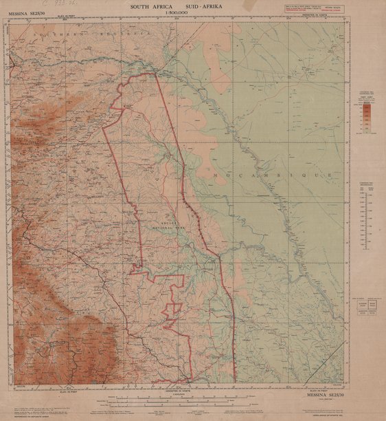
Carte topographique du South Africa
Cette carte donne des renseignements concernant la topographie de l'Afrique du Sud (Messina) vers les années 1951.
Simple
- Date (Publication)
- 1951-01-01
- Date (Creation)
- 1950-01-02
- Date (Revision)
- 1950-01-02
- Citation identifier
- CD-CRSN-DOC539
-
-
afrique
-
-
-
sud
-
-
-
topographique
-
-
GEMET - INSPIRE Themes
-
-
Altitude
-
- Use limitation
-
None
- Access constraints
- Other restrictions
- Other constraints
-
Pas de restriction d'accès public selon INSPIRE
- Denominator
- 500000
- Language
- English
- Topic category
-
- Elevation
- Description
-
Liste des emprises
N
S
E
W
))
- Reference system identifier
- urn:ogc:def:crs:EPSG:6.11 / 4258 / 6.11
- Distribution format
-
-
JPEG JFIF
(
)
-
JPEG JFIF
(
)
- Name of the resource
-
Centre de Recherche en Sciences Naturelles (CRSN) Lwiro
- Hierarchy level
- Dataset
Conformance result
- Date (Creation)
- 2010-11-23
- Explanation
-
See the referenced specification
- Pass
- Yes
- Statement
-
Printed in the Union of South Africa by the Government Printer, Pretoria, 1951
.
- File identifier
- CD-CRSN-DOC539 XML
- Metadata language
- Français
- Character set
- MD_CharacterSetCode_utf8
- Hierarchy level
- Dataset
- Date stamp
- 2016-12-03
- Metadata standard name
-
ISO19115
- Metadata standard version
-
2003/Cor.1:2006
Point of contact
Centre de Recherche en Sciences Naturelles (CRSN)
Lwiro
,
Bukavu
,
00000
,
Belgique
None
Overviews
Spatial extent
N
S
E
W
Provided by

Associated resources
Not available