 Geocatalogue of the Royal Museum for Central Africa
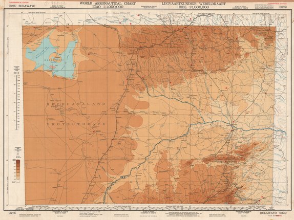
World aeronautical chart, Bulawayo
Cette carte livre des informations à propos de l'aéronautique de Bulawayo en Afrique du Sud vers les années 1954.
Simple
- Date (Publication)
- 1954-01-01
- Date (Creation)
- 1954-01-01
- Date (Revision)
- 1954-01-01
- Citation identifier
- CD-CRSN-DOC742
Owner
Centre de Recherche en Sciences Naturelles (CRSN)
Lwiro
,
Bukavu
,
00000
,
République Démocratique du Congo
None
-
-
bulawayo
-
-
-
aeronautique
-
-
GEMET - INSPIRE Themes
-
-
Altitude
-
-
GEMET - INSPIRE Themes
-
-
Occupation des terres
-
- Use limitation
-
None
- Access constraints
- Other restrictions
- Other constraints
-
Pas de restriction d'accès public selon INSPIRE
- Denominator
- 1000000
- Language
- English
- Character set
- MD_CharacterSetCode_utf8
- Topic category
-
- Elevation
- Imagery base maps earth cover
- Description
-
Liste des emprises
N
S
E
W
))
- Reference system identifier
- EPSG / urn:ogc:def:crs:EPSG:6.11:4209
- Distribution format
-
-
JPEG JFIF
(
)
-
JPEG JFIF
(
)
- Protocol
-
http
- Name of the resource
-
Centre de Recherche en Sciences Naturelles (CRSN) Lwiro
- Hierarchy level
- Dataset
Conformance result
- Date (Creation)
- 2010-11-23
- Explanation
-
See the referenced specification
- Pass
- Yes
- Statement
-
Compiled and drawn by the Trigonometrical Survey Office (1952). Printed in the Union of South Africa by the Government Printer, Pretoria (1954).
- File identifier
- CD-CRSN-DOC742 XML
- Metadata language
- Français
- Character set
- MD_CharacterSetCode_utf8
- Hierarchy level
- Dataset
- Date stamp
- 2017-01-04
- Metadata standard name
-
ISO19115
- Metadata standard version
-
2003/Cor.1:2006
Point of contact
Centre de Recherche en Sciences Naturelles (CRSN)
Lwiro
,
Bukavu
,
00000
,
République Démocratique du Congo
None
Overviews
Spatial extent
N
S
E
W
Provided by

Associated resources
Not available