 Geocatalogue of the Royal Museum for Central Africa
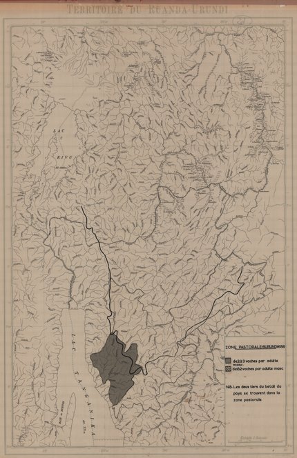
Carte de zone pastorale du Burundi, 1955
Sur cette carte topographique nous pouvons localiser la zone pastorale du Burundi. La limite avec le Congo Belge (actuelle République Démocratique du Congo) est visible. Cette carte montre aussi les lacs, les rivières et les marais. Les deux tiers du bétail dans ce pays se trouvent dans la zone pastorale.
Simple
- Date (Publication)
- 1955-01-01
- Date (Creation)
- 1955-01-04
- Date (Revision)
- 1955-01-04
- Citation identifier
- CD-CRSN-DOC94
Owner
Centre de Recherche en Sciences Naturelles (CRSN) Lwiro
Lwiro
,
Bukavu
,
00000
,
Belgique
None
-
-
burundi
-
-
-
zone
-
-
-
pastorale
-
-
-
vache
-
-
-
limite
-
-
GEMET - INSPIRE Themes
-
-
Hydrographie
-
-
GEMET - INSPIRE Themes
-
-
Occupation des terres
-
- Access constraints
- Other restrictions
- Other constraints
-
Pas de restriction d'accès public selon INSPIRE
- Denominator
- 500000
- Language
- Français
- Topic category
-
- Inland waters
- Imagery base maps earth cover
- Description
-
Liste des emprises
N
S
E
W
))
- Reference system identifier
- urn:ogc:def:crs:EPSG:6.11 / 4258 / 6.11
- Distribution format
-
-
JPEG JFIF
(
None
)
-
JPEG JFIF
(
None
)
- Name of the resource
-
Centre de Recherche en Sciences Naturelles (CRSN) Lwiro
- Hierarchy level
- Dataset
Conformance result
- Date (Creation)
- 2010-11-23
- Explanation
-
See the referenced specification
- Pass
- No
- Statement
-
Carte réalisée par l'Institut Géographique Militaire en 1955.
- File identifier
- CD-CRSN-DOC94 XML
- Metadata language
- Français
- Character set
- MD_CharacterSetCode_utf8
- Hierarchy level
- Dataset
- Date stamp
- 2016-09-12
- Metadata standard name
-
ISO19115
- Metadata standard version
-
2003/Cor.1:2006
Point of contact
Centre de Recherche en Sciences Naturelles (CRSN) Lwiro
Lwiro
,
Bukavu
,
00000
,
Belgique
None
Overviews
Spatial extent
N
S
E
W
Provided by

Associated resources
Not available