 Geocatalogue of the Royal Museum for Central Africa
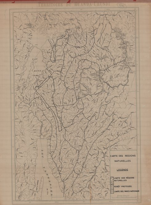
Carte du territoire des régions naturelles du Ruanda Urundi
Cette carte montre les limites des régions, des aires protégées ainsi des parcs nationaux dans le Territoire du Ruanda-Urundi vers les années 1955.
Simple
- Date (Publication)
- 1955-01-01
- Date (Creation)
- 1955-01-01
- Date (Revision)
- 1955-01-01
- Citation identifier
- CD-CRSN-DOC96
Owner
Centre de Recherche en Sciences Naturelles (CRSN) Lwiro
Lwiro
,
Bukavu
,
00000
,
République Démocratique du Congo
-
-
ruanda
-
-
-
urundi
-
-
-
zone
-
-
-
naturelle
-
-
-
protgée
-
-
-
limite
-
-
-
parc
-
-
GEMET - INSPIRE Themes
-
-
Habitats et biotopes
-
-
GEMET - INSPIRE Themes
-
-
Régions biogéographiques
-
- Access constraints
- Other restrictions
- Other constraints
-
Pas de restriction d'accès public selon INSPIRE
- Denominator
- 500000
- Language
- Français
- Character set
- MD_CharacterSetCode_utf8
- Topic category
-
- Biota
- Biota
- Description
-
Liste des emprises
N
S
E
W
))
- Reference system identifier
- EPSG / urn:ogc:def:crs:EPSG:6.11:4209
- Distribution format
-
-
JPEG JFIF
(
None
)
-
JPEG JFIF
(
None
)
- Protocol
-
http
- Name of the resource
-
Centre de Recherche en Sciences Naturelles (CRSN) Lwiro
- Hierarchy level
- Dataset
Conformance result
- Date (Creation)
- 2010-11-23
- Explanation
-
See the referenced specification
- Pass
- No
- Statement
-
Cette carte a été tracée par l'Institut Géographique Militaire en 1955.
- File identifier
- CD-CRSN-DOC96 XML
- Metadata language
- Français
- Character set
- MD_CharacterSetCode_utf8
- Hierarchy level
- Dataset
- Date stamp
- 2016-09-12
- Metadata standard name
-
ISO19115
- Metadata standard version
-
2003/Cor.1:2006
Point of contact
Centre de Recherche en Sciences Naturelles (CRSN) Lwiro
Lwiro
,
Bukavu
,
00000
,
République Démocratique du Congo
Overviews
Spatial extent
N
S
E
W
Provided by

Associated resources
Not available