 Geocatalogue of the Royal Museum for Central Africa
2004
Type of resources
Topics
Provided by
Years
Formats
Scale
-
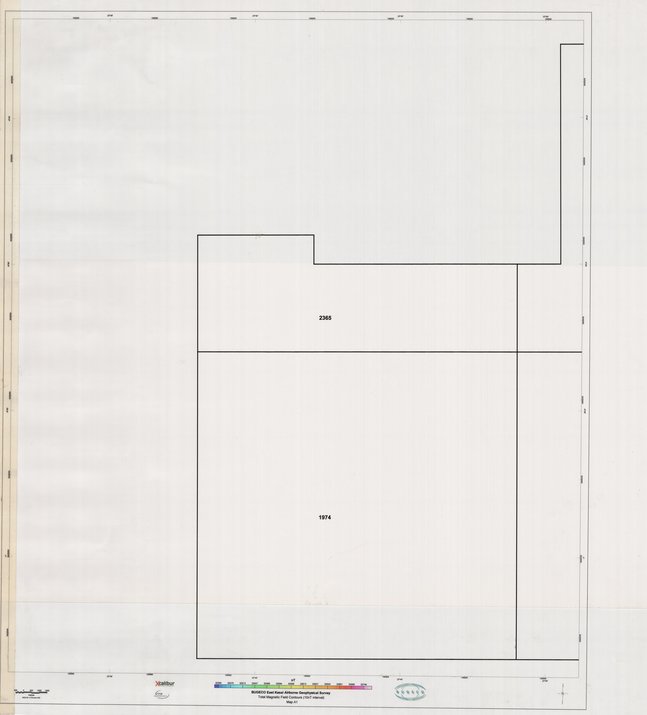
Title: East Kasai Airborne Geophysical Survey, Total Magnetic Field Contours (10nT interval) MapA1 - Scale: 50000 - ZAI074
-
DTM - Hight resolution gradiometer magnetic survey East Kasai Province, Democratic Republic of Congo
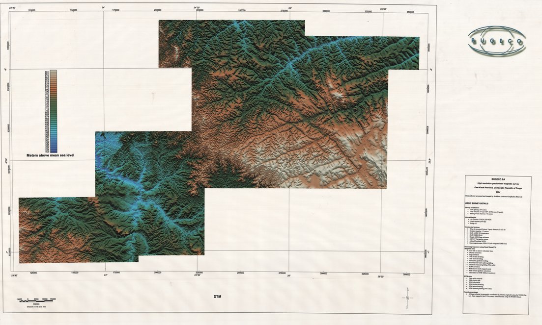
Title: DTM, Hight resolution gradiometer magnetic survey East Kasai Province, Democratic Republic of Congo - Scale: 230000 - ZAI068
-
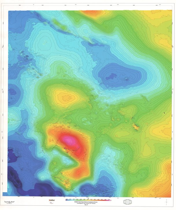
Title: East Kasai Airborne Geophysical Survey, Total Magnetic Field Contours (5nT interval) MapA3 - Scale: 50000 - ZAI076
-
Title: East Kasai Airborne Geophysical Survey, Total Magnetic Field Contours (5nT interval) MapA4 - Scale: 50000 - ZAI077
-
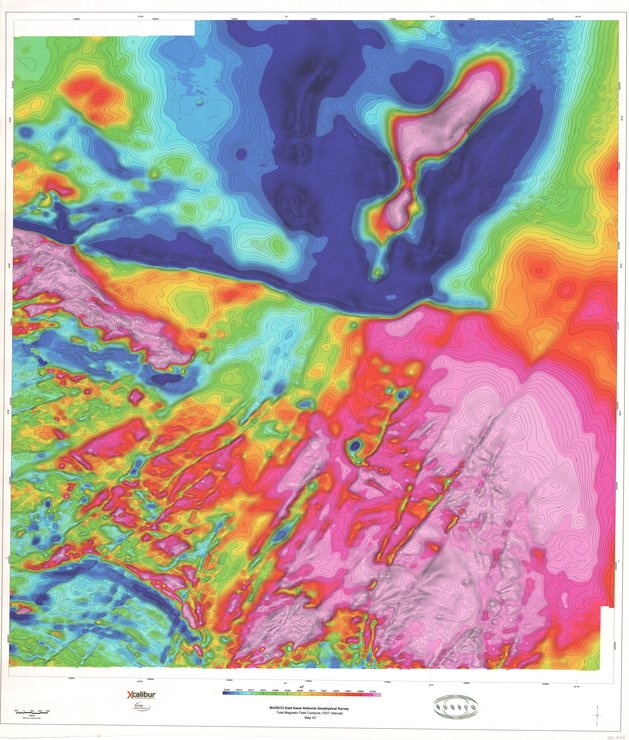
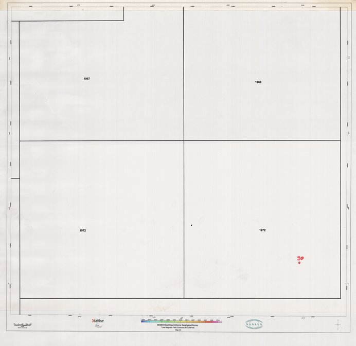
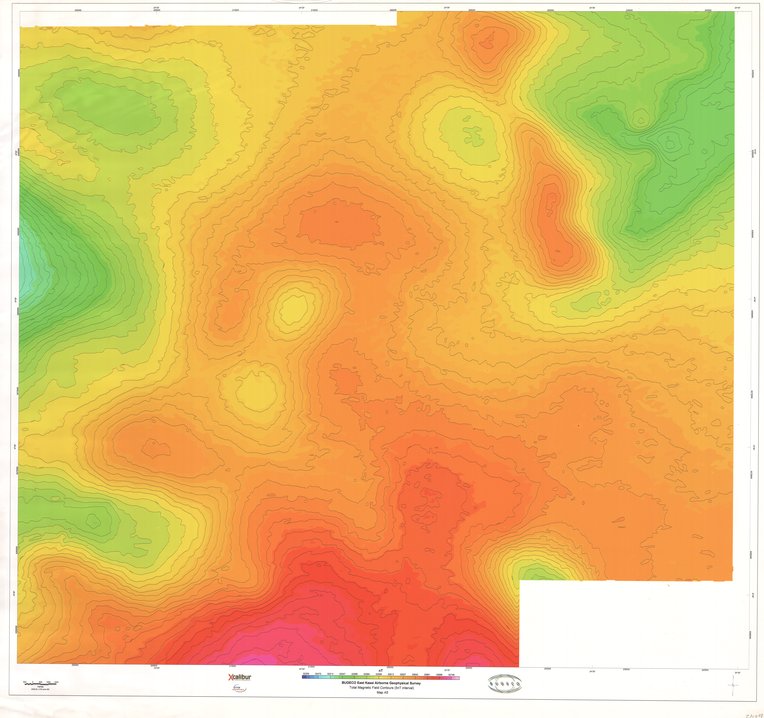
Title: East Kasai Airborne Geophysical Survey, Total Magnetic Field Contours (10nT interval) MapA2 - Scale: 50000 - ZAI075
-
Title: East Kasai Airborne Geophysical Survey, Total Magnetic Field Contours (5nT interval) MapA4 - Scale: 50000 - ZAI077
-
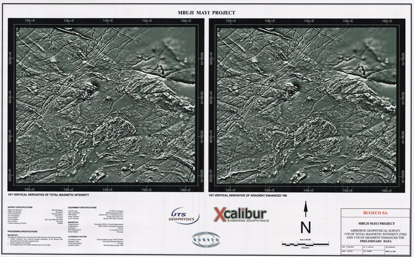
Title: 1 st vertical derivative of toatal magnetic intensity 1 st vertical derivative of gradient enhanced TMI, Mbuji Mayi Project - Scale: 100000 - ZAI071
-
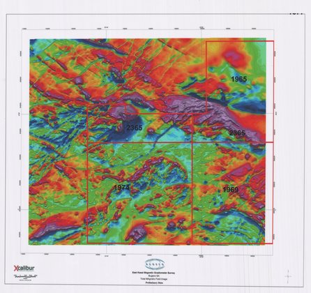
Title: East Kasai Magnetic Gradiometer Survey, Total Magnetic Field Image Preliminary data - Scale: 105000 - ZAI069 De Beers permits
-
Title: East Kasai Airborne Geophysical Survey, Total Magnetic Field Contours (5nT interval) MapA5 - Scale: 50000 - ZAI078
-
Title: East Kasai Airborne Geophysical Survey, Total Magnetic Field Contours (10nT interval) MapA2 - Scale: 50000 - ZAI075